How to Use City Render Planning to Improve Urban Transportation Systems
Transportation Design City Render is the best method to create 3D visualizations that show how roads, bridges, public transit systems, and pedestrian pathways are designed before the construction phase. Moreover, construction professionals can visualize how transportation is combined with city layouts. Following are the professionals who need transportation design renderings:
- Government Agencies
- Municipalities
- Architecture Firms
- Engineering Firms
- Real Estate Developers
- Urban Planners
- Transportation Authorities
- Construction Companies
- Design Consultants
- Infrastructure Development Firms
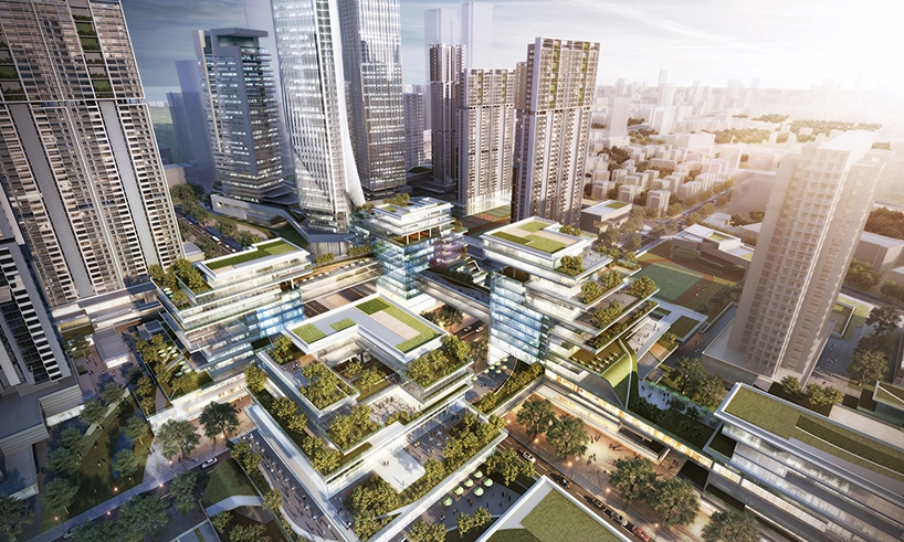
It is true that with the growth of the city, the challenges also start growing concerning transportation. The main issues are traffic congestion, environmental degradation, and accessibility disparities. However, with advanced methods such as site plan rendering, you can improve transportation infrastructure. The aerial view gives you a complete view from the top of how the traffic and buildings are connected with each other.
Without any further duo let’s jump right into our topic!
IF YOU WANT TO TRANSFER URBAN AREAS, THEN YOU NEED TO TRY PROFESSIONAL TRANSPORTATION DESIGN CITY RENDERS AND LOOK INTO SMARTER AND SAFER URBAN TRANSPORTATION SOLUTIONS!
Overview of City Render Planning
City render planning is all about using 3D rendering and advanced visualisation methods. The professionals and the government look into the digital models of the roads and other buildings. With the help of these digital images and animation, professionals can optimize the city layout and transportation networks. Even if you want to change something in the design, the visualizers change it with the help of a few clicks in the shortest time.
Transportation Systems Design with 3D Rendering
The professionals can not only visualize the space through 3D images but also through animation. The professionals give the path information to the Visualizers and ask them to provide a full overview of the proposed transportation design. Resultantly, the experts provide traffic study analysis to complete the 3D design. The main mission is to convert transportation planning, engineering, and construction services into reality. The following designs are included in city render planning.
- Signing and Striping Design
- Noise Wall and Roundabout Design
- Multi-use Recreational Trail Design
- Construction Traffic Control and Detour Design
- At-grade Intersection & Grade-separated Interchange Design
- Reconstruction and Rehabilitation Design
- Bridge, Highway, City Streets, Urban Roadway Design
- Water Resources, Drainage, and Utilities Design
Steps to Use City Render Planning for Urban Transportation Systems
Step# 1 Gather Data
The first step is to start with Gathering data about roads, bridges, railways, etc. In addition to that, you must also collect information on traffic patterns and congestion hotspots. When you gather all the information correctly, it will help you design the perfect transportation design city renders.
Step #2 Creating Digital Twins
The second step is to develop a digital twin of the city using GIS (Geographic Information Systems), CAD (Computer-Aided Design), and 3D rendering tools. How is this beneficial? With the help of virtual 3D models, professionals can visualize the city’s physical characteristics.
Step# 3 Scenario Modeling
Scenario modelling means experimenting with different concepts of transportation such as expanding public transit, creating car-free areas, or using smart traffic systems. This experimentation can help you visualize how different scenarios can affect traffic and safety.
Step #4 Stakeholder Engagement
To share your ideas and what you are thinking regarding the transportation systems of the city, present your plans to all project members. Using 3D renderings is the best way to showcase what your design ideas are and to gain feedback!
Step#5 Implementation and Monitoring
When you are done with transportation design render planning then you are prepared to implement it. Using digital models can help you monitor the progress and predict any unexpected challenges in the future.
Challenges and Considerations in City Render Planning
By outsourcing transportation design city renders to professionals, it can help you mitigate several challenges. Especially, when you are in the real estate business you need to hire experts for 3D Real Estate rendering services because you cannot handle these challenges without expertise:
- If you have poor data quality, then you will never achieve the desire and you will make flawed decisions.
- Without using advanced rendering software, you can never speed up the process and accurately budget wisely. If you do, you will have to pay an expensive cost to invest in the software.
- Implementing city render planning requires skilled professionals familiar with GIS, CAD, etc.
NOW TAKE ONE STEP FURTHER TO PLAN A BETTER URBAN TRANSPORTATION SYSTEMS FUTURE AND START USING RENDERING OR 3D ARCHITECTURAL ANIMATION SERVICES FROM A RELIABLE COMPANY SUCH AS SMA ARCHVIZ!
Final Thoughts!
Transportation design city render is one of the effective solutions in this modern urban industry. The use of 3D visualization and modern tools helps professionals to deal with transportation challenges along with accessibility and efficiency. However, with the increase in technology, city render planning will increasingly influence the future of transportation systems. So why not? Take a chance and protect our systems with efficient initial planning? Over the years, The advancements have given more power to city render planning to transform transportation systems for the better!


