Entitlement Renderings: How 3D Visualization Helps Developers Win Zoning & Planning Board Approvals
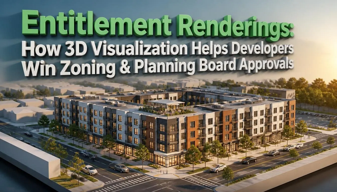
Entitlement renderings are accurate 3D visualizations that reflect a project’s officially approved legal scope and design constraints (entitlements), made to win zoning and planning board approval. They show the project’s true height, scale, and placement inside its real street. They help developers in three ways: board members understand the project without reading technical plans, neighbors see facts instead of fears, and fewer open questions mean fewer delays at the hearing.
Below, you’ll learn which view boards expect, what each approval stage needs, how to keep images accurate, and how to present them.
What are Entitlement Renderings?
Entitlement renderings refer to visual designs of a building project that have officially been granted legal approval (entitlements) by a city or zoning board. They are a type of architectural visualization built as proof, not as advertising. A marketing image sells a lifestyle. A hearing image proves facts about height, bulk, distance, and views.
How are Entitlement Renderings Different from Marketing Renders?
Both come from the same 3D model. The difference is in the choices:
| Factor | Hearing image | Marketing image |
| Goal | Prove the project fits the code and the street | Sell or lease space |
| Camera | Eye level, from real public spots | Wherever it looks best |
| Light | Plain daylight, true shadows | Sunset glow, dramatic sky |
| Trees | Size at planting | Fully grown |
| Neighbors | Shown as they are | Often cropped out |
Good architectural renderings for planning approval also carry labels a board can check, such as building height in feet and the zoning limit drawn as a faint outline. That turns a picture into an exhibit.
How Do 3D Renderings Help Developers Win Zoning Approvals?
3D renderings help developers win zoning approvals by replacing complex 2D blueprints with clear, realistic visual models that eliminate ambiguity for city planners and community members. A planning commission is usually made up of volunteers, not architects. Flat plans ask them to imagine a building that doesn’t exist yet. A clear 3D view shows it to them.
Here is what changes when a board can see the project:
- People understand it faster: A 2007 study on public participation in planning in Wales found that the public struggles to read 2D plans and elevations. The largest group of participants, 42.4%, chose 3D models as their preferred way to see new projects.
- Neighbors calm down: Residents frequently raise concerns during public hearings due to a lack of understanding. Fear grows when people can’t picture a project. Eye-level views from their own street answer “what will I see?” before the hearing starts.
- Fewer questions mean fewer delays: When commissioners can see height and fit, they ask fewer follow-ups and send fewer projects back for changes.
- Fixes replace denials: A clear view lets the board ask for small changes, like more trees or a lower roofline, instead of saying no.
- Visual Proof of Compliance: Renderings clearly demonstrate how a project fits local ordinances, including setbacks, step-backs, bulk planes, and neighborhood character. This visual evidence makes it harder for reviewers to reject a proposal out of generic uncertainty or caution.
Delay is where the money goes. A 2022 study by NAHB and NMHC found that community opposition adds an average of 5.6% to multifamily development costs. It also delays new housing by 7.4 months on average.
Next to months of land and loan costs, 3D rendering for zoning approval is a small line item. That’s why entitlement renderings belong in the plan from day one, not the week before the hearing.
Which 3D Renderings Do Planning Boards Want to See?
Boards want views that answer their real questions about height, privacy, traffic, and fit. Six views cover almost every hearing:
| View | What It Proves |
| Eye-level street view | How the building looks from the sidewalk and the homes next door |
| Aerial view | How it fits the block, with parking and open space |
| Colored site plan | Setbacks, driveways, parking, and landscape buffers |
| Massing study | The building’s size compared with the zoning limit |
| Shadow study | Shade on nearby yards at set dates and times |
| Before-and-after pair | The exact change, shown from the same camera spot |
Flat CAD site plans are hard for residents to read. A site plan rendering fixes this by adding color, trees, shade, and scale cars to the same layout, so anyone can tell pavement from lawn in seconds. Many developers order one before the first staff meeting, so planners can mark it up early.
For a site plan approval rendering, include property lines, the building footprint, fire lanes, parking counts, and the buffer along shared property edges. Label each item. Commissioners should never have to guess.
What Visuals Does Each Approval Stage Need?
Each stage has a different audience with a different worry, so the image set should change as the project moves. Don’t reuse one hero image for every meeting.
| Stage | Who decides | Best visuals |
| Pre-application meeting | Planning staff | Simple 3D model on the lot with the zoning limit shown |
| Community meeting | Neighbors | Eye-level views from their streets, before and after |
| Design review | Design board | Close facade views with materials labeled |
| Zoning variance or conditional use permit | Zoning board of appeals | One view per request, allowed vs. proposed side by side |
| Main hearing | Planning board | The full set of six views above |
| Rezoning | City council | A few clear views plus one wide aerial |
What Works Best for a Rezoning?
Rezoning presentation visuals should show three scenes from the same camera:
- the site today
- what current zoning allows
- what you propose.
If the allowed option is a bulky box and your plan steps down toward neighbors, the image makes your case for you.
How Do You Keep Renderings Accurate Enough for a Hearing?
Tie every image to real survey data and show your method. A view nobody can check is a view opponents can attack.
Use this checklist given below:
- Camera at standing eye height, about 5 feet, on public ground
- A normal lens, close to 50mm on a full-frame camera, since wide lenses make buildings look smaller
- Survey or LiDAR data for ground levels and neighbor heights
- Trees at planting size, or labeled with the growth year
- True shadows for a stated date and time
- A small map and note showing the camera spot, date, and lens
The strongest version is a verified view. This is a photomontage where the 3D model is placed into a real site photo and lined up with surveyed points. The UK’s Landscape Institute Technical Guidance Note 06/19 sets out this method step by step, and you can cite it in your packet.
Matching a model to a site photo takes survey files and software most architecture offices don’t use every day. That’s why many developers hire 3D exterior rendering services for these views, while the architect stays focused on the drawings.
Accurate entitlement renderings also protect you after the vote. Cities often expect the finished building to match the hearing exhibits.
How Should You Present Renderings at the Hearing?
Get final images into the agenda packet on time, then let the street views lead your talk. Commissioners read the packet at home, so late images lose their best chance to persuade.
To prepare renderings for planning board hearings:
- List what the board must decide, and pick one view to answer each point.
- Shoot site photos from spots neighbors will name, like the nearest corner or park.
- Share camera spots with planning staff early and ask what they want to see.
- Check every height and distance in the images against the drawings.
- Submit the images, a camera map, and a short method note before the packet deadline.
At the public hearing:
- Open with the eye-level view, not the aerial. People judge buildings from the sidewalk.
- Show before, then after, in the same frame.
- Keep 3 to 5 image slides in your talk and hold the rest for questions.
- Bring printed boards, because projectors wash out color.
- Say your method out loud, such as “these views match surveyed points. One sentence like that stops most fake-image claims.
What Rendering Mistakes Make Boards Lose Trust?
The biggest mistake is making the building look better than it will be. Once a board catches one trick, it doubts every other exhibit.
Avoid the following mistakes:
- Sunset skies and glowing windows: They read as a sales pitch.
- Full-grown trees on opening day: Neighbors will point out that those trees take years to grow.
- Wide-angle lenses: They shrink the building and lose credibility fast.
- Cropping out the house next door: It hides the exact thing people came to discuss.
- Images that don’t match the drawings: Staff will flag it, and opponents will quote it.
- AI-generated images as exhibits: They invent details and can’t hold true scale.
Bottom Line
Zoning and planning approvals are won or lost on understanding. Board members and neighbors vote on what they can picture, and most people can’t picture a building from flat plans. Entitlement renderings close that gap. They show true height, scale, and fit from the places people actually stand, so the hearing moves from fear and guessing to facts and small fixes. The developers who get approved faster don’t make prettier images. They make honest ones, match each view to the board’s real questions, and show them to staff and neighbors early.
For your next project, before you order a single image, write down the three questions you expect neighbors to ask at the hearing. Plan one eye-level view from a real public spot that answers each question. Then show those views at the community meeting, so the board isn’t the first group to see them.
Frequently Asked Questions
Q1: Are 3D renderings required for planning approval?
3D renderings requirement for planning approval depends on the city and the project. Most cities require a site plan and elevations, while 3D views are often optional for small projects. Larger, taller, or contested projects are different, since staff and board members usually expect them. Ask planning staff at your first meeting, and plan on eye-level views if neighbors are likely to attend.
Q2: How much do hearing renderings cost?
Price of hearing renderings depends on the number of views, how much of the real street must be modeled, whether views are survey-verified, and how fast you need them. A ready design model and a frozen design keep costs down, since most overruns come from re-rendering after changes. Next to months of land and loan costs, a hearing set is a small expense.
Q3: How long does it take to make a hearing image set?
Plan on three to six weeks for still images from a finished design model. Survey-verified views need extra time for site photos and survey points. Work backward from the agenda packet deadline, not the hearing date, because images must be in the record before board members start reading.
Q4: Do entitlement renderings help with neighbor opposition?
Yes, entitlement renderings help with neighbor opposition when they are honest. Opposition grows in the gap between what people fear and what they can see. Eye-level views from neighbors' own streets replace rumors with facts. Show them at a community meeting before the formal hearing, so you hear real concerns early and fix what you can.